Want more images or videos?
Request additional images or videos from the seller.

Antique County Map of Lancashire, English, Framed Cartography, Moule, Victorian

$689.72
£511
€623.49
CA$983.37
A$1,013.78
CHF 576.02
MX$12,832.56
NOK 6,596.23
SEK 6,910.37
DKK 4,660.95

About the Item

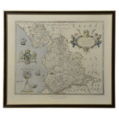
This is an antique county map of Lancashire. An English, atlas reproduction of the Thomas Moule original, dating to the late Victorian period, circa 1900. Fine county cartography, reproduced in the late Victorian period Displays a desirable aged patina and in good order Presented behind clear, bright glass with a lilac card border Later frame with gilt accents and dressed with hanging wire to the reverse Superb cartography by Thomas Moule (1784 - 1851) writer, antiquarian and map maker Gives excellent detail to Lancashire, in the North West of England Accentuated with Gothic borders and heraldic emblems, a Moule hallmark Hand coloured borders and decoration for greater visual appeal Wonderful vignette of Nelson's monument in Liverpool Scale is given in English Miles with increments from 1-10 miles George Virtue included these Moule maps in James Barclay's Complete & Universal English Dictionary This edition likely featured within a later print run of the reference volume This is a colourful antique Lancashire county map, with a detailed and quality reproduction of the Thomas Moule original. A treat for Lancs residents, descendants or collectors. Delivered ready to display. Dimensions: Max Width: 32cm (12.5'') Max Depth: 2cm (.75'') Max Height: 37.5cm (14.75'') Map Width: 20.5cm (8'') Map Depth: cm ('') Map Height: 26cm (10.25'')
  • Dimensions:
    Height: 14.77 in (37.5 cm)Width: 12.6 in (32 cm)Depth: 0.79 in (2 cm)
  • Style:
    Late Victorian (Of the Period)
  • Materials and Techniques:
  • Place of Origin:
  • Period:
    1900-1909
  • Date of Manufacture:
    Circa 1900
  • Condition:
    Wear consistent with age and use. Presented in good antique condition.
  • Seller Location:
    Hele, Devon, GB
  • Reference Number:
    Seller: 262371stDibs: LU2645351944162

More From This Seller

View All
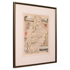
Antique County Map, Gloucestershire, English, Framed, Thomas Moule, Victorian

Antique County Map, Gloucestershire, English, Framed, Thomas Moule, Victorian

Located in Hele, Devon, GB

This is an antique county map of Gloucestershire. An English, atlas reproduction of the Thomas Moule original, dating to the late Victorian period, circa 1900. Striking mid-19th cen...

Category

Antique Early 1900s British Late Victorian Maps

Materials

Glass, Paper
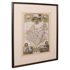
Antique Leicestershire Map, English, Framed Cartographic Interest, Victorian

Antique Leicestershire Map, English, Framed Cartographic Interest, Victorian

Located in Hele, Devon, GB

This is an antique lithography map of Leicestershire. An English, framed atlas engraving of cartographic interest, dating to the mid 19th century and later. Superb lithography of Le...

Category

Antique Mid-19th Century British Victorian Maps

Materials

Wood

Antique County Map, Staffordshire, English, Framed Litho, Cartography, Victorian

Antique County Map, Staffordshire, English, Framed Litho, Cartography, Victorian

Located in Hele, Devon, GB

This is an antique lithography map of Staffordshire. An English, framed atlas engraving of cartographic interest, dating to the mid 19th century and later. Superb lithography of St...

Category

Antique Mid-19th Century British Victorian Maps

Materials

Glass, Wood, Paper

Antique Nottinghamshire Map, English, Framed, Cartographic Interest, Victorian

Antique Nottinghamshire Map, English, Framed, Cartographic Interest, Victorian

Located in Hele, Devon, GB

This is an antique lithography map of Nottinghamshire. An English, framed atlas engraving of cartographic interest, dating to the mid 19th century and later. Superb lithography of ...

Category

Antique Mid-19th Century British Victorian Maps

Materials

Wood

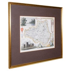
Antique Map of County Durham, English, Framed, After Moule, Victorian, C.1900

Antique Map of County Durham, English, Framed, After Moule, Victorian, C.1900

Located in Hele, Devon, GB

This is an antique map of County Durham. An English, atlas reproduction of the Thomas Moule original, dating to the late Victorian period, circa 1900. Excellent reproduction cartogr...

Category

Antique Early 1900s British Late Victorian Maps

Materials

Glass, Paper
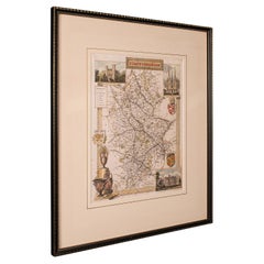
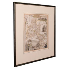
Antique County Map, Oxfordshire, English, Framed Cartography Interest, Victorian

Antique County Map, Oxfordshire, English, Framed Cartography Interest, Victorian

Located in Hele, Devon, GB

This is an antique lithography map of Oxfordshire. An English, framed atlas engraving of cartographic interest, dating to the mid 19th century and later. Superb lithography of Oxfo...

Category

Antique Mid-19th Century British Mid-Century Modern Maps

Materials

Wood

You May Also Like

Map of Lancashire

Map of Lancashire

Located in Cheshire, GB

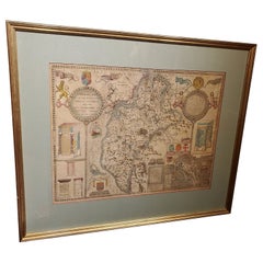
Saxton Map of Lancashire hand coloured. Encased in an ebonised frame. Dimensions Height 21 Inches Width 24 Inches Depth 1 Inches

Category

Early 20th Century British Maps

Materials

Paper

Framed 17th Century Map of Cumberland, England by John Speed, 1610

Framed 17th Century Map of Cumberland, England by John Speed, 1610

By John Speed

Located in Middleburg, VA

A fascinating and richly detailed antique map of Cumberland County in northwest England, drawn and published by the celebrated English cartographer John Spe...

Category

Antique Early 17th Century English British Colonial Maps

Materials

Copper, Gold Leaf

Large Antique County Map of the West Riding of Yorkshire 'North Part', England

Large Antique County Map of the West Riding of Yorkshire 'North Part', England

Located in Langweer, NL

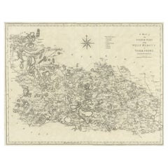
Antique map titled 'A Map of the North Part of the West Riding of Yorkshire from the best Authorities'. Original old county map of the north part of the West Riding of Yorkshire, Eng...

Category

Antique Early 19th Century Maps

Materials

Paper

Map Bedfordshire General Framed

Map Bedfordshire General Framed

Located in BUNGAY, SUFFOLK

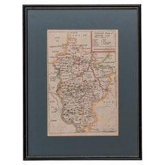
A general map of Bedfordshire with its hundreds A scale of 5 miles in the original green mount and traditional black and gold frame. Measures: 36cm 14" high.

Category

Antique 18th Century English Georgian Maps

Materials

Paper

Large Original Vintage Map of the United Kingdom, circa 1920

Large Original Vintage Map of the United Kingdom, circa 1920

Located in St Annes, Lancashire

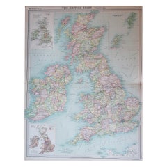
Great map of The United Kingdom Unframed Original color By John Bartholomew and Co. Edinburgh Geographical Institute Published, circa 1920 Free shipping.    

Category

Vintage 1920s British Maps

Materials

Paper

Large 17th Century Hand Colored Map of England and the British Isles by de Wit

Large 17th Century Hand Colored Map of England and the British Isles by de Wit

By Frederick de Wit

Located in Alamo, CA

A large hand colored 17th century map of England and the British Isles by Frederick de Wit entitled "Accuratissima Angliæ Regni et Walliæ Principatus", published in Amsterdam in 1680. It is a highly detailed map of England, Scotland, the Scottish Isles...

Category

Antique Late 17th Century Dutch Maps

Materials

Paper